Thursday, May 9, 2013

Predicting the Future


Yellowstone lies in a semi-arid geographical region. In simplest terms this means that the demand of water is greater than the supply in any given area. This allows only the toughest of plant life to survive in the region. The climate of Yellowstone varies drastically throughout the year, potentially diving well below freezing in the winter months and high into the nineties during warmer months. Due to such cold temperatures the Glaciers of Yellowstone go through drastic changes as well which creates many of the wonderful water and landscape features you can find within.

Glacial Erratics are a common form of landscape left behind by Glaciers. Although many of Yellowstone's landforms are formed by Volcanic activity there are many such as the above Erratic that are formed from former Glaciation in the region.
image courtesy of: http://travellogs.us/Miscellaneous/Geology/Glacial%20erratics/Glacial%20Erratic.htm

Yellowstone also lies within a Rhyolite Caldera (a large crater-like hole), which was formed by the last explosion of the active super Volcano. The Super Volcano supplies the heat needed for Yellowstone’s biggest attractions; the geothermal activity.

Geothermal Activity in Yellowstone National Park fueled by the hot spot lying underneath the Earth's Surface
image courtesy of: http://www.slate.com/articles/health_and_science/the_green_lantern/2010/10/could_yellowstone_power_my_home.html

The many defining features of Yellowstone can help us to predict what the area may look like in the future.

1,000 years

Yellowstone is filled with perennial meandering streams and rivers meaning these water features flow year round. Due to the processes of erosion and deposition the paths of the streams will likely change and move to other areas of the landscape.

Meandering river that runs through Yellowstone National Park. You can see deposited material making almost a beach like area along the inside of the first bend in the river and the cutbank on the opposite side. Throughout time this will continue and ultimately change the direction and course of the river.
image courtesy of:http://www.bigskyfishing.com/National_parks/yellowstone/yellowstone_river_park.htm


The plant life will also most likely change in 1,000 years due to the global climate change. We have already discovered a migration of Pine Trees as time has progressed and climates have changed locally. Pine trees rely heavily on colder temperatures. As temperatures in Yellowstone increase we can most likely find the pine trees migrating towards climates that are more suitable. If pattern continues this will be Northward.

10,000 years

In 10,000 years Yellowstone will encounter even further drastic changes. Currently Yellowstone has many beautiful falls throughout the Yellowstone River’s course. However, these most likely will not be existent in the next 10,000 years. Due to erosion and undercutting we can expect that eventually the stream will reach a point of equilibrium where the falls will no longer be there and the river will run smooth.

As you can see in the diagram as water flows over the falls small rocks and debri are carried along which nibbles away at the soft rock underneath the hard surface. Once it has nibble away enough the hard rock will break and collapse causing the waterfall to retreat further.
image courtesy of:http://www.geocaching.com/seek/cache_details.aspx?guid=57d27ccb-1146-4214-a7d3-7f8ae880e754


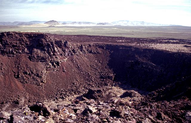
We can also expect other landform changes from the rivers and streams. The Yellowstone now runs through the mountains creating a narrow V-shaped canyon. This canyon will most likely grow larger and wider with time from erosion and mass wasting along the steep slopes. Glaciation will also largely assist in widening the canyon. The ice that gets carried by the river will slowly start to round the sides of the canyon making it a parabolic canyon. 
This image depicts what Yellowstone Canyon currently looks like. Notice the V-shape.
image courtesy of: http://commons.wikimedia.org/wiki/File:Grand_canyon_of_Yellowstone_and_Yellowstone_fall.jpg


The diagram above shows what could happen as the canyon Glaciates from hardened snow pack that doesn't completely melt in the warmer months. Eventually the glacier will nibble away at the steep slopes creating more of a porabolic shaped valley instead of the rigid V-shaped canyone we know now. 
image courtesy of:http://www.uwgb.edu/dutchs/GeolColBk/MtnGlaciers.htm
1,000,000 years

Within the next million years it is quite possible that Yellowstone’s Super volcano will erupt. In the case of this nearly every part of Yellowstone as we know it will be destroyed and covered by magma. There will no longer be the geothermal activity although as the hot spot continues to move it they may develop once again further Northeast of the current location.

Conclusion

It is safe to say that within the next million years Yellowstone will go through many drastic changes. Eventually Yellowstone will be nothing like the gem we know today. It will be given a chance to wipe free and rebuild to the glorious park it once was. 

References

1. http://www.livescience.com/28821-yellowstone-supervolcano-bigger-plume.html
2.Class lectures on glacial and fluvial lnadscapes, Volcanism and erosion/mass wasting
http://clasfaculty.ucdenver.edu

Wednesday, April 17, 2013

Weather and Climate


Weather and Climate are two terms that can easily be mistaken as one in the same, however they are not. Weather refers to what is happening right now and climate is what can be expected or in other words the average weather in a given location over a period of time. Growing up near Yellowstone National Park it can be safely said that the climate and weather are relatively ‘unpredictable’. This can be attributed to a few key features in Yellowstone National Park including its Altitude and its large surrounding Mountain Ranges.


 As you can see in the above image Yellowstone has many varying elevations. We can see the tall mountain peaks, the hills and the lake. There are also many Valleys throughout the Park that we are unable to see through this image. The varying altitudes can give very good insight into the unpredictability of the weather and climate.
Image courtesy of Google Images

            Yellowstone National Park has altitudes ranging from 5,000-11,000 feet above sea level. Yellowstone Lake sits at 7733 feet in elevation but the Park has high mountains and low valleys that make the climate so unpredictable. Lower elevations remain at milder temperatures however can still vary significantly. During summer, (June-September) temperature can range from below freezing to highs around 80 degrees Fahrenheit. Spring and fall temperatures can range from lows in the teens to highs of about 30-60 degrees Fahrenheit. Coldest of all in the winter months temperatures range from well below zero to 20 degrees Fahrenheit. This is due to atmospheric pressure changes as you increase in elevation the pressure of the air around decreases causing the air molecules to expand and move slower. This causes the air to become cooler which can explain why mountains sustain snow much longer than the Valleys.

As described in the image the pressure exerted on the man at a much higher altitude (top of the mountain) is much less than the amount exerted on the man at a much lower altitude (the ground).
Image courtesy of Google Images


  The Rocky Mountains cause much of Yellowstone National Park’s weather including winds and precipitation. As warm moist air from the Valleys collides with the Rocky Mountains it is forced up the windward side of the mountain. When it reaches near the top of the mountain clouds and tiny water droplets are formed causing precipitation. The wind then becomes dry and follows down the leeward side of the mountain in an act referred to as the Chinook Winds. 
The Chinook Winds also greatly attribute to the wide range of temperatures in Yellowstone National Park. As the winds carry over the top of the mountain the air warms. Dry air warms much quicker then moist air which can sometimes cause a rapid increase in temperature of almost 40 degrees. 
Image courtesy of Google Images.


References:

http://clasfaculty.ucdenver.edu/callen/1202/
Lectures: Earth's Temperature and Climate
Weather
Pressure and Winds

http://www.nps.gov/yell/planyourvisit/weather.htm

https://en.wikipedia.org/wiki/Chinook_wind


Wednesday, March 6, 2013

Rock Weathering


Weathering is the process of decaying rock. There are two main forms of rock weathering: physical and chemical. Physical weathering can be caused by frost, pressure, heat, salt, expansion and contraction and root pressure.
The above diagram shows exactly how the physical processes (pressure, frost, heat and root pressure) occurs within the rock causing decay.
http://home.comcast.net/~rhaberlin/mwstyg.htm


Chemical weathering is caused by hydrolysis (addition of water breaking chemical bonds), dissolution (dissolve), hydration/dehydration (addition or subtraction of water to molecules), oxidation (combination with oxygen creates rust) and moss/ lichens (organisms attached to rock that secrete acids breaking down rock). While traveling through Yellowstone National Park many of these processes may be observed.

Look closely at the canyon walls in this image of Yellowstone Canyon. They seem as though they have been painted with reds, yellows and whites. The coloration can be attributed to various different processes of weathering. The trees growing out of the canyon walls can also lead to rock decay. 
http://www.beilbyvisualarts.com/id1.html

The brilliant colors of Yellowstone Canyon as well as its formation can be attributed to rock weathering. The red color is due to oxidation, the addition of oxygen to the rock molecules, creating a rust within the rock and slowly breaking down the individual molecules until they are weakened. The rock of the canyon also decays through root pressure. This occurs when seedlings of the tree find their way into joints (cracks) within the rock, as the tree gets larger so does its’ root system this expansion creates pressure pushing apart the joint until it snaps and breaks off. As the rock decays and breaks off it falls down the slope of the canyon wall and is swept by the rushing river below.

As you look closely at this rock you can see tiny discoloration on the rock called Moss. Also observe tiny finger sized holes in the rock called Alveoli which are formed by salt weathering process.
http://www.iusedtohatebirds.com/2010/07/yellowstone-national-park.html

 Moss/lichen and salts can also cause decay in the rock of Yellowstone National Park. The tiny moss organisms cover around rocks and secrete acid that breaks down the molecules creating the jagged sides of the rock. Alveoli (tiny holes) are a form of cavernous salt weathering. As salt crystals expand in the pores the surrounding rock weakens and eventually breaks away creating the finger sized cavernous holes.

Friday, February 15, 2013

Rhyolite Caldera: Yellowstone Super Volcano


The Yellowstone Rhyolite Caldera or 'Super Volcano' currently lies underneath the Yellowstone Lake. The size of the Super Volcano Explosion is estimated to be 6,000 times the size of the Mt. St. Helens eruption in 1980. This is due to the massive hot spot found under Yellowstone National Park, which fuels both the volcano and the hydrothermal areas (geysers, hot springs and mud pots).

Below are images I took of the hydrothermic activity in Yellowstone.


The term hot spot refers to regions considered Volcanic or fed by hot magma that is closer to the Earth’s Crust than other regions. There are many hot spots throughout the world however; Yellowstone is one of two prominent hot spots in the United States. 


Yellowstone is a Caldera meaning it has collapsed in on itself along fault lines. The image below depicts the operations associated within and around the Caldera of Yellowstone. 

Video explanation/ demonstration of the formation of Calderas:


The hot spot has been feeding the Volcano for over 16 million years and leaving a trail of over 100 Calderas stretching over 500 miles from its current location under Yellowstone Lake. As shown in the below image this trail is caused by the drifting of the North American Plate in the Southwest Direction. 


This path can also be traced by evaluating the basalt remnants along the Snake River Plain. Flood Basalts are commonly found along the plain however there are many other forms of Basalt that can be identified as well. Flood Basalts are typically large areas that have been covered during an eruption by hot magma. The magma has a low viscosity therefore it floods the area rather than building itself up to create a larger Volcano. Once the magma cools it solidifies into hard rock and over hundreds of millions of years creates the formations we see today on the Snake River Plain.


Images are credit of Google Images and my own personal collection of Yellowstone Photography.